Travel Your Way

Be a Traveler, Not a Tourist­

Las Vegas for Introverts? Yes, it can be done!

A Crowded and Crazy Place

On the surface, Las Vegas seems like the last place for someone like me who doesn’t like crowds and would prefer to minimize my exposure to them as much as possible.

However, I do like to visit Las Vegas from time to time and have always enjoyed my experiences there.  I have learned that the key to that enjoyment is some prior planning of lodging and activities to ensure I can visit on my own terms and would like to share those tips with you based on my prior visits.

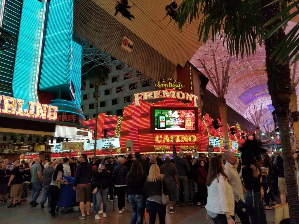
Las Vegas used to be a no-nonsense gambling town with free parking on the Strip, inexpensive casino buffets to get you inside to gamble, and reasonably priced shows.  No longer.  Las Vegas (especially the Strip and Fremont Street) have been transformed into a Disneyland for adults, and like Disneyland (or any other theme park), food and entertainment is at a premium and the gambling has become incidental as more non-gamblers (like me) flock to one of the most premier destinations in the U.S.

Freemont Street at Night

Freemont Street at Night

Timing is Everything

One of the first things to decide when visiting Las Vegas is when to go.  My research has shown than the time with the least crowds is probably just after the holidays in January and right before things start picking up for spring break in March.  These are also the times when the hotels on the Strip seem to offer the best deals to try to entice you to stay at one of their hotel-casinos.  However, it is not always possible to visit at the time of your choosing.  My most recent visit was with my wife, mother, and niece at the end of March, which is during Spring Break season in North America.  Spring Break is a good time to visit because the temperate weather offers a welcome contrast to the cold, snowy weather that persists in other parts of the U.S.

I have found that it is best to use the following two strategies when visiting Fremont St. and the Strip to manage your exposure to crowds:

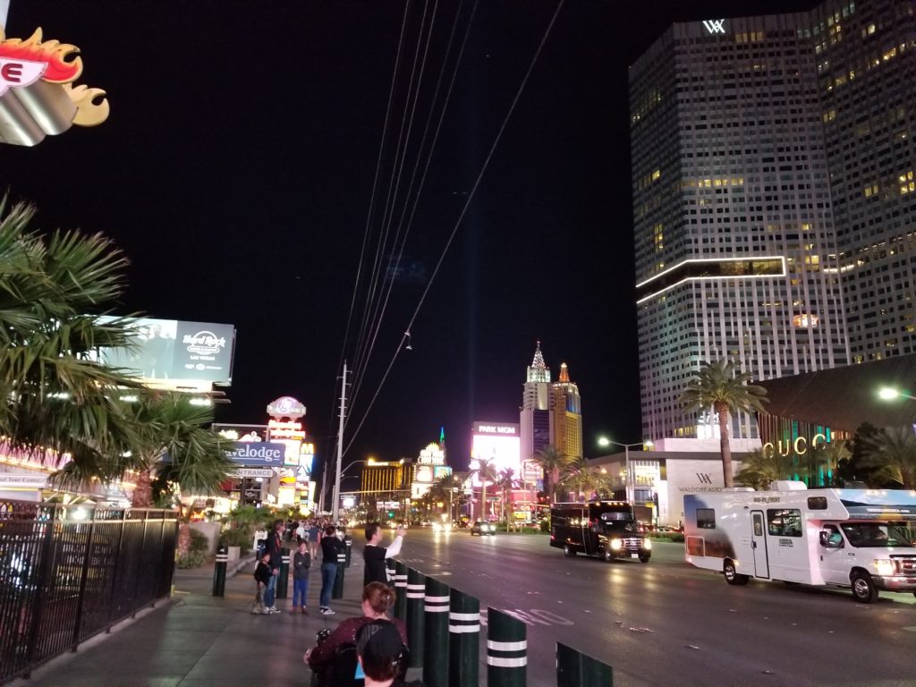
  1. Plan to see a specific show or do a specific activity in the evening and have an escape plan ready to get back to the sanctuary of your room or rented house when you have had enough.  Also, ensure those you travel with will support your plan.  For example, when we saw the Beatles Love show at the Mirage during our most recent trip, we were able to take in plenty of the lights and nighttime atmosphere of the Strip just by traveling to and from the show.  We even took a slow drive down the strip from the Mirage and could observe the goings on from the comfort of our own vehicle (kind of like a wildlife safari).
  2. Go earlier in the day.  I enjoy walking the strip the most just after sunrise when most of the nighttime revelers are still asleep and everything is much quieter.  I also can appreciate the architecture of the Strip and take good pictures in the light of the rising sun.  One good time to visit the Flamingo is at 8:30 a.m. when they feed the pelicans at the bird sanctuary (which also includes flamingos, turtles, and ducks).  This is a relaxing (and free) activity you can do on the Strip.  I have generally found that the Strip was not overly crowded until late afternoon.

Location, Location, Location

To avoid crowds in a place like Las Vegas, it is important to also know where to stay.  If you can’t visit during one of the low times, suggest staying somewhere away from Fremont St. or the Strip.  During our Spring Break trip, we stayed in North Las Vegas (about a 15 min drive from Fremont St. and a 20 min drive from the Strip) in a Vacation Rental by Owner (VRBO).  We like the VRBOs, because there is more space and a full kitchen that allows you to cook your own meals without having to eat out for every meal (which in Las Vegas can get expensive).  Also, the VRBO had a smoke-free environment, which is much more difficult to find when staying on the Strip.

When exploring the Strip, we found that the heaviest density of crowds seemed to be near the Bellagio and Caesars Palace, which are the most extravagant and upscale hotel-casinos.  Once we were down at the south end of the Strip by the Luxor, Treasure Island, and Mandalay Bay, the crowds were much more manageable in the evening.  Another option for fewer people is to check out hotel-casinos further from Fremont St. and the Strip or just outside Las Vegas.  These places still do offer the inexpensive buffets and room rates because they are competing with the better-known venues.

Las Vegas Strip

Las Vegas Strip

Getting Around

If you are flying in to McCarren Airport, you can get to your lodging easily using Uber, Lyft, or taxi.

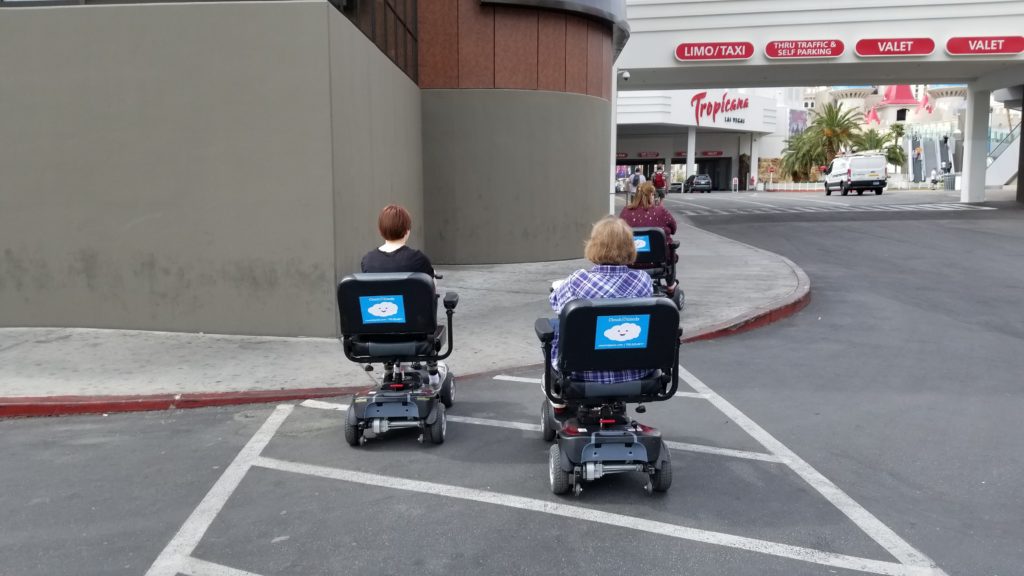
Fremont St., which features hotel-casinos like the Golden Nugget, is quite compact and walkable.  It is possible to stay within the confines of Fremont St. without needing a car at all.  The Strip proper is about 4 miles long, which is also walkable, but for some may be a bit far.  One alternative we tried was to rent three electric scooters for my mother, my wife, and my niece (I decided to get my steps in) and used them to explore the Strip.  I also rode a scooter for a while and it was a lot of fun!

If you decide to stay away from Fremont St. or the Strip, you may want to rent a car (or use the car you drove in with) to get around.  It is still possible to find some free parking on Fremont St. and on the Strip, but that is getting more and more scarce.

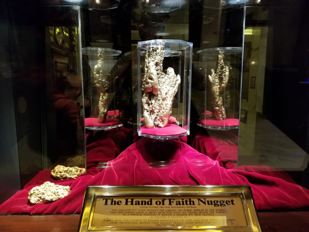
A golden nugget at The Golden Nugget

A golden nugget at The Golden Nugget

Scooting along The Strip

Scooting along The Strip

What to do if you are a non-gambler in Vegas

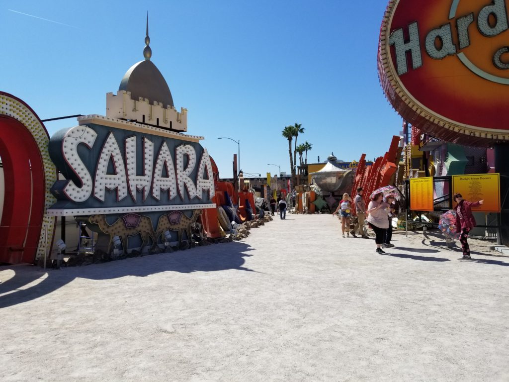
Even if you refuse to play one hand at the tables or drop one dollar at a slot machine, there is still plenty to do in Las Vegas.  There are a number of interesting museums, including one for vintage hotel-casino signs, which are lit up at night with music in a multi-media show.  There are also museums featuring relics from the Titanic, a mob museum, a pinball museum (with working vintage pinball machines you can play), a museum featuring plasticized human bodies, and an atomic museum that provides free tours to the Nevada Test Site (please see my blog on this specific topic).  Also, there are at least 50 shows and concerts you can see at any given time that suit all kinds of tastes in entertainment.  There are some of the best known high-fashion shops right on the Strip, including Louis Vuitton and Prada.  Finally, there are numerous restaurants all the way from fast food to the best gourmet.  I mused that if I had a million dollars of disposable income that I could blow in Las Vegas (without gambling a cent), I could probably see a different show or attraction every day, eat at a different restaurant or buffet every day, and do a different activity every day, and still by the end of one month barely scratch the surface of all the things to do in Las Vegas.

Neon Sign "Boneyard"

Neon Sign “Boneyard”

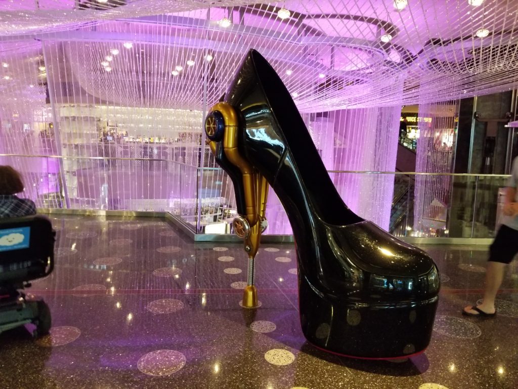
Giant Shoe in the Cosmopolitan

Giant Shoe in the Cosmopolitan

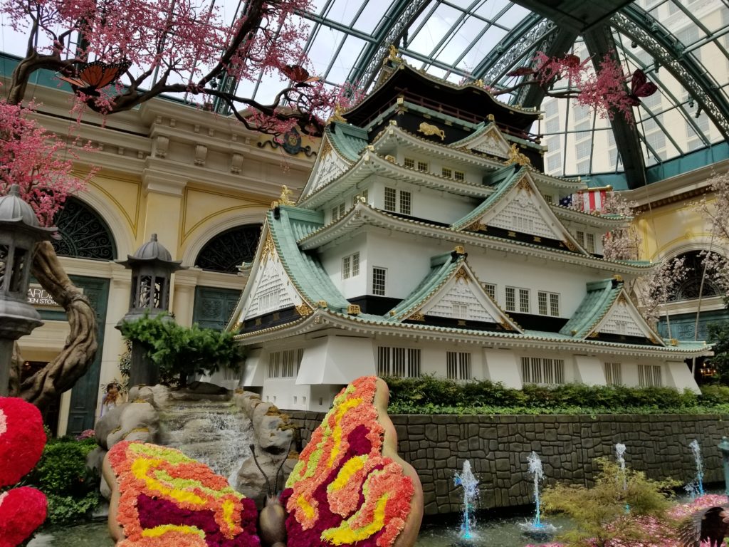
Japanese garden at the Bellagio

Japanese garden at the Bellagio

Excursions

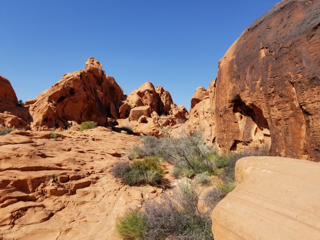
When you get tired of the hustle and bustle of Las Vegas itself, consider an excursion outside the city.  If you like wildlife and nature, there are several parks and conservation areas within an hour’s drive of Las Vegas, including the Red Rock Canyon National Conservation Area, Valley of Fire State Park, the Sloan Canyon National Conservation Area, and the Lake Meade National Recreation Area.  Also, you can visit the Hoover Dam, which offers tours of the dam and its workings.  Nearby the Hoover Dam is Boulder City, which is a planned city that was built by the federal government to house the workers who built the dam in a “vice-free” environment.  In fact, to this day Boulder City is one of two municipalities in the State of Nevada that prohibits gambling.

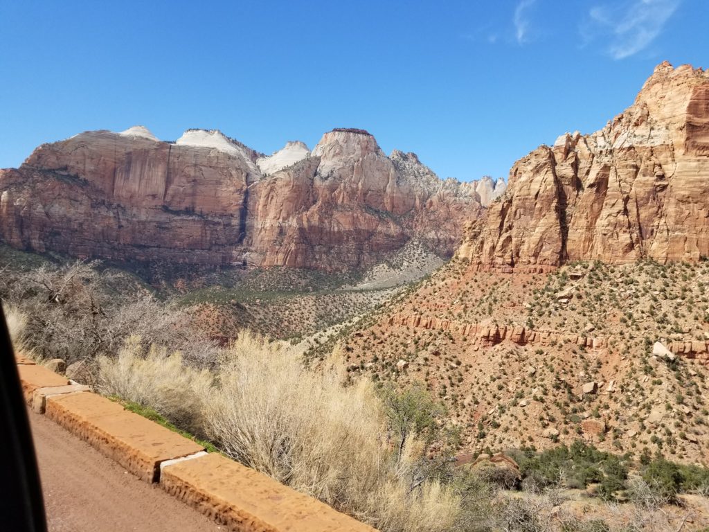
Further out there is also the western part of the Grand Canyon National Park that can be reached in just over two hours driving from Las Vegas, or Zion National Park, which is about 2.5 hours driving from Las Vegas.

Valley of Fire State Park

Valley of Fire State Park

Zion National Park

Zion National Park

Resources

In conclusion, there are lots of things to do in and near Las Vegas as an introvert and as a non-gambler.

VRBO: www.vrbo.com

Titanic Artifacts Museum – Luxor Hotel and Casino: https://luxor.mgmresorts.com/en/entertainment/titanic.html

Bodies… The Exhibition – Luxor Hotel and Casino:

https://luxor.mgmresorts.com/en/entertainment/bodies-the-exhibition.html

National Atomic Testing Museum: https://nationalatomictestingmuseum.org/

Nevada National Security Site: https://www.nnss.gov/

The Mob Museum: https://themobmuseum.org/

Neon Museum: https://www.neonmuseum.org/

Pinball Hall of Fame Museum: http://www.pinballmuseum.org/

Red Rock Canyon: https://www.redrockcanyonlv.org/

Valley of Fire State Park: http://parks.nv.gov/parks/valley-of-fire

TYW Dispatch: Visiting the U.S. Capitol – 7 Nov 2018

In search of an affordable breakfast

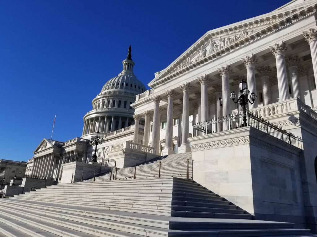
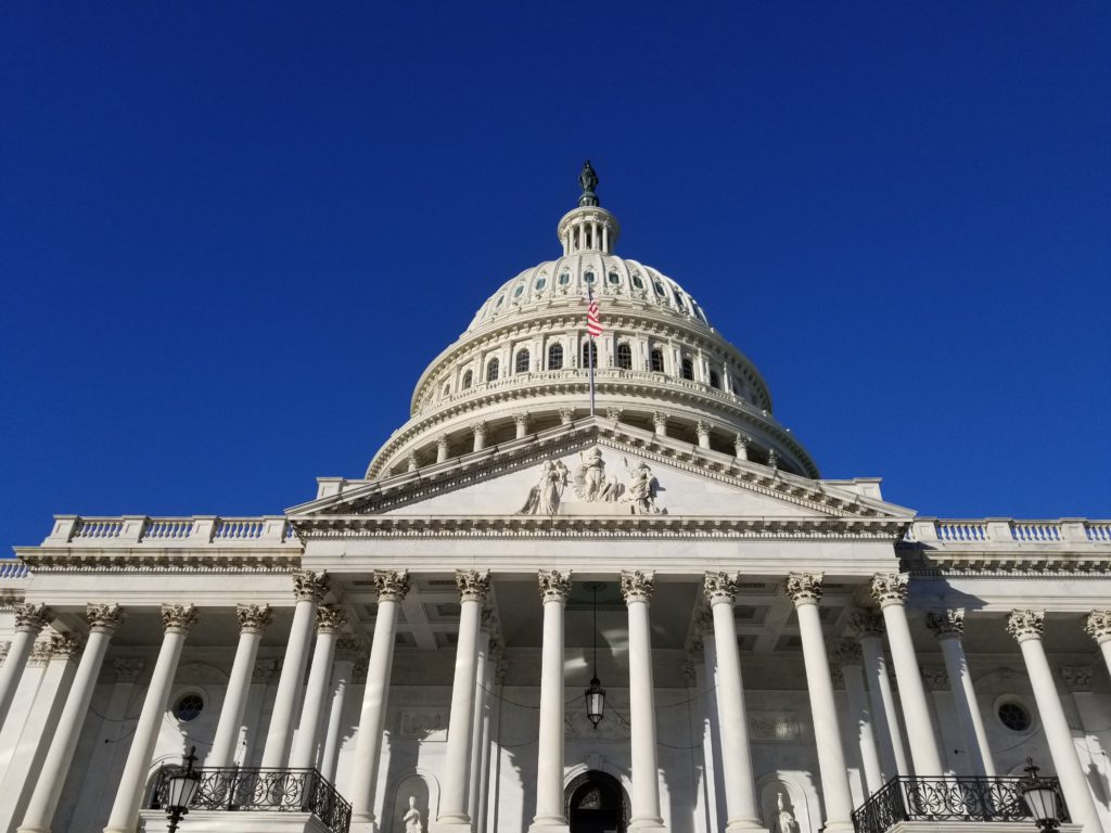
It was the day after Election Day and I had several hours to kill.  First, I decided to find an affordable place to have breakfast.  I was staying at a four-star hotel on Capitol Hill that charged $30 for a breakfast buffet with the same items I had enjoyed at other hotels for half the price.  As I looked at Google Maps, I noticed that the U.S. Capitol had a cafeteria that appeared to be open to the public.  I figured: “Breakfast at the Capitol, why not?”  So, I walked a few blocks to the US Capitol and took some pictures this amazing and beautiful neoclassical building that symbolized the very essence of my country.  There was only one problem: How do I get in?  I followed signs for the visitor entrance and only found entrances for people who worked there (i.e., members of congress and their staff) guarded by police with machine guns.  This was quite different from when I lived in the area twenty years earlier and could simply walk up the steps in front of the building and into the front door to the rotunda.

20181107_084440

20181107_084630

Welcome to the U.S. Capitol!

It turns out the visitor entrance is on the east side of First St. and East Capitol St.  To access the visitor center, you walk down into a tunnel under First St.  Near the visitor center, I noticed that the lines for the U.S. Capitol tours were quite short, so maybe it would be worth trying to get into an impromptu tour after breakfast.

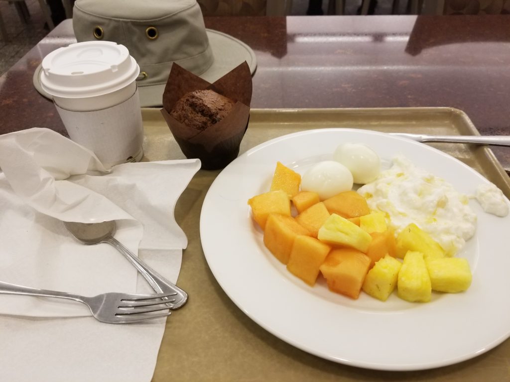
The U.S. Capitol cafeteria was very quiet and there did not seem to be anyone about except for the cafeteria staff.  The food was basic cafeteria fare that included some healthy choices and the prices were quite reasonable.  I realized that this was one of those secret quiet places that not as many people seem to be aware of.

20181107_090304

A quick repast before my tour

Welcome to the Capitol

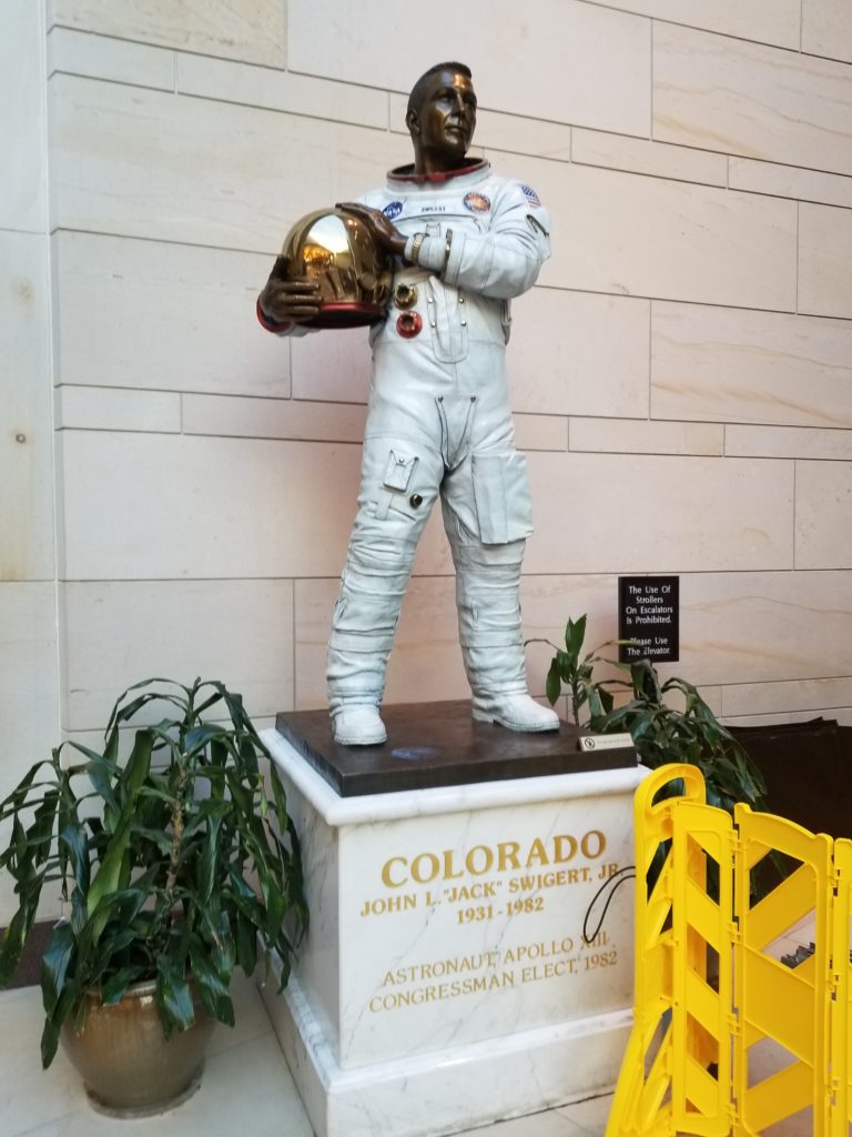
After my quiet and relatively healthy breakfast, I went back to the visitor center to see how easy it might be to get a tour of the Capitol.  As I walked to the ticket booth, I noticed a striking statue representing my home state of Colorado.  The statue was of astronaut Jack Swigert (1931-1982), who flew on the ill-fated Apollo 13 mission, which was supposed to land 3 Americans on the moon.  The harrowing near-disaster captivated the U.S. and the world for six days as everyone watched the heroism and bravery of those three astronauts and numerous members of their team on Earth as they were able to safely make it back home.  I was reminded how such events of heroism have a way of bringing everyone together, if only for a brief time.

20181107_085559

Jack Swigert (Colorado) by George and Mark Lundeen (1997)

My trip to the front of the ticket line was quick and I was immediately given a ticket to be a part of the next tour at 9:10 a.m.  I was pleasantly surprised at how quickly I could get a tour without any prior planning.  Our large group of about 200 people were conducted into a large auditorium for a 15-minute video presentation to provide an orientation and a brief history of the U.S. Capitol.  Before the video began, a guide asked all assembled what was the motto of the United States of America.  After a few awkward seconds of silence, I had to blurt out “E pluribus unum” to which the guide approvingly acknowledged my correct answer.  The motto is a Latin phrase that translates into English as “out of many, one.”  Beyond that, it’s meaning could point to U.S. exceptionalism and possibly imply that we are somehow “better” than other countries.  However, to others this motto may be interpreted as how our country was formed out of a rich diversity of ideas and people and speaks to the multicultural aspects of our nation.  I’ll leave it up to you to form your own opinion.

Saved from the Inferno

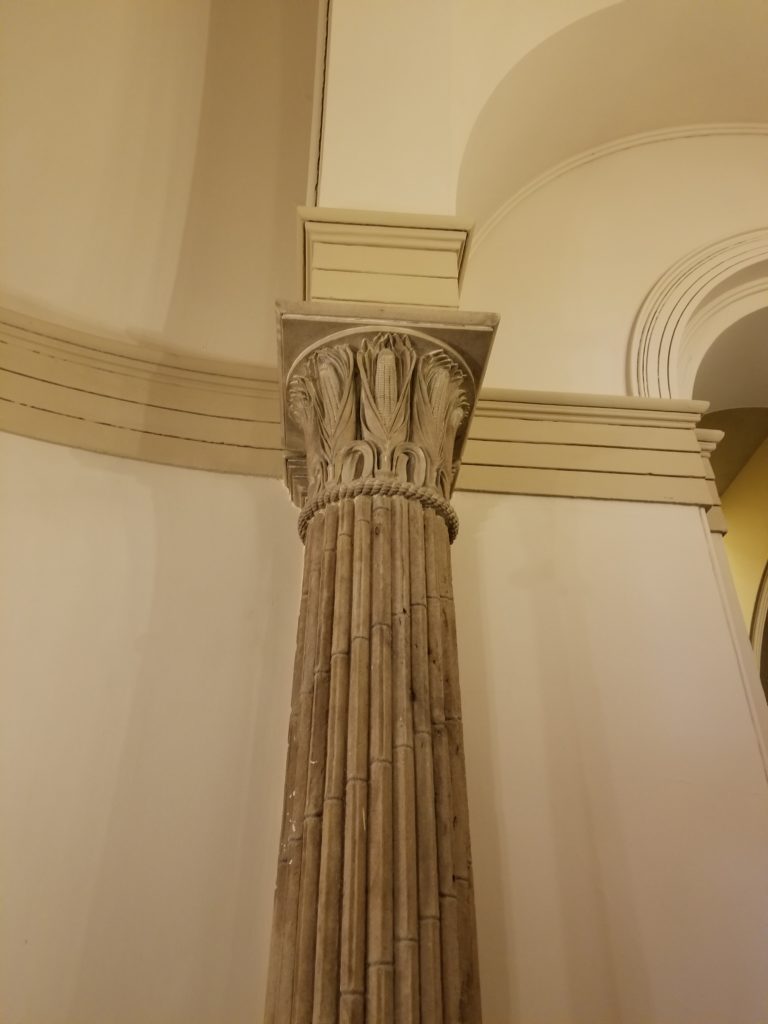
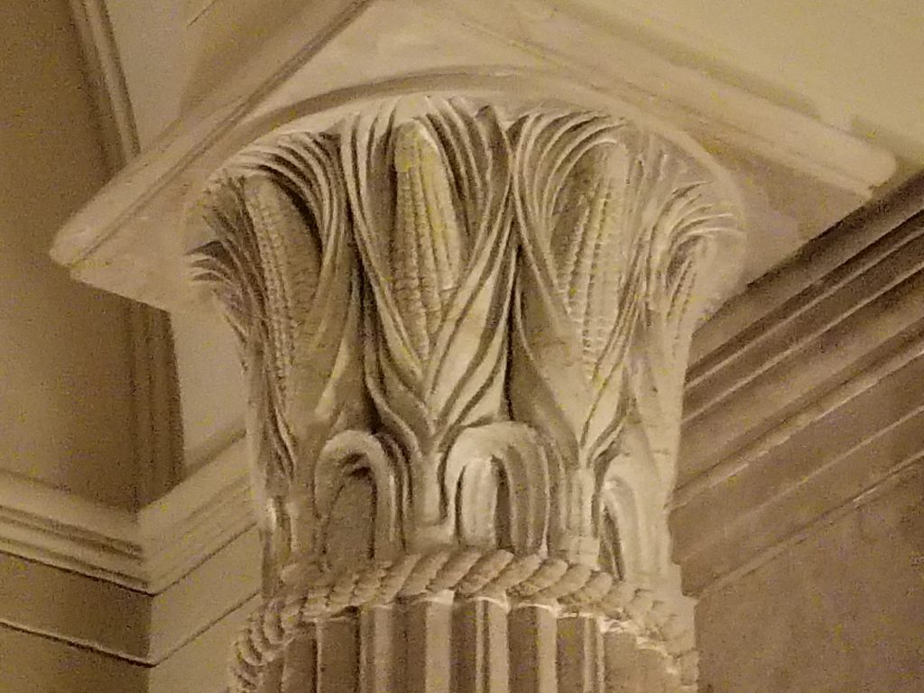
After exiting the auditorium, I felt a mixture of pride in knowing the answer to the guide’s question and a bit of embarrassment of probably seeming a bit of a know all.  Thankfully, we were next broken up into five smaller groups and would be each conducted separately by our own tour guide.  The first feature our guide pointed out was some unique neoclassical architecture.  The classical columns were familiar, but upon closer inspection the capitols at the top of each column were not the typical leafy Corinthian variety or Ionic with their scroll-like appearance.  These capitols were capped with corn cobs, representing the only example in the world where such capitols appear.  Our guide also informed us that these columns were some of the only items spared by the fire set by the British during the War of 1812.  The British set fire to the Capitol and White House and other government buildings on 24 Aug 1814 after defeating American forces at the Battle of Bladensburg, forcing the U.S. government (including fourth U.S. President James Madison [1751-1836]) to flee Washington D.C.  I remembered that this episode was the last time the U.S. suffered a direct attack on its shores until the horrible events of 11 Sep 2001.

20181107_095352

20181107_095454

The Highest Chamber in the Land

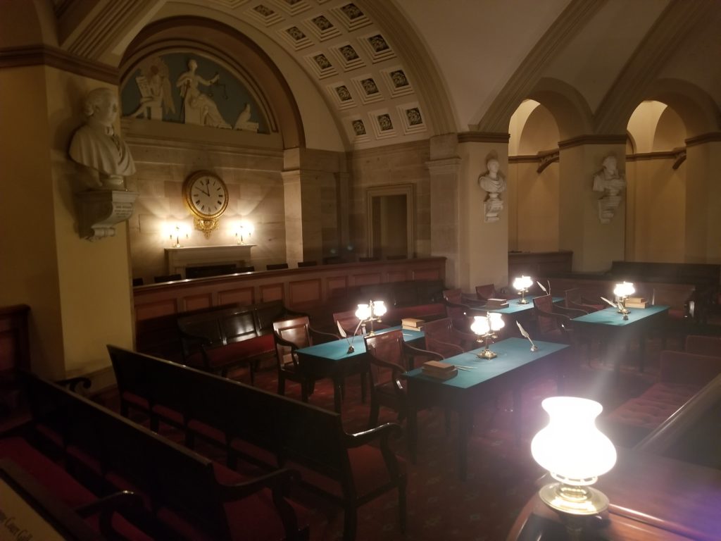
Next, we were conducted into the beautifully restored chamber where the Supreme Court met from 1810 until 1860.  After serving as the chamber for the highest U.S. court, the room was used alternately as a committee room for U.S. Congress, a Congressional Library, and for storage before it was carefully restored to its original condition for the 1976 U.S. Bicentennial.

20181107_095842

A Really Big Dome

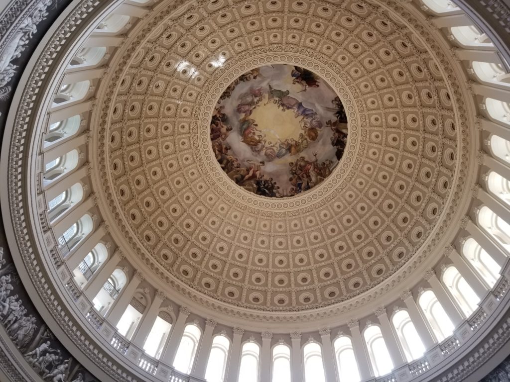
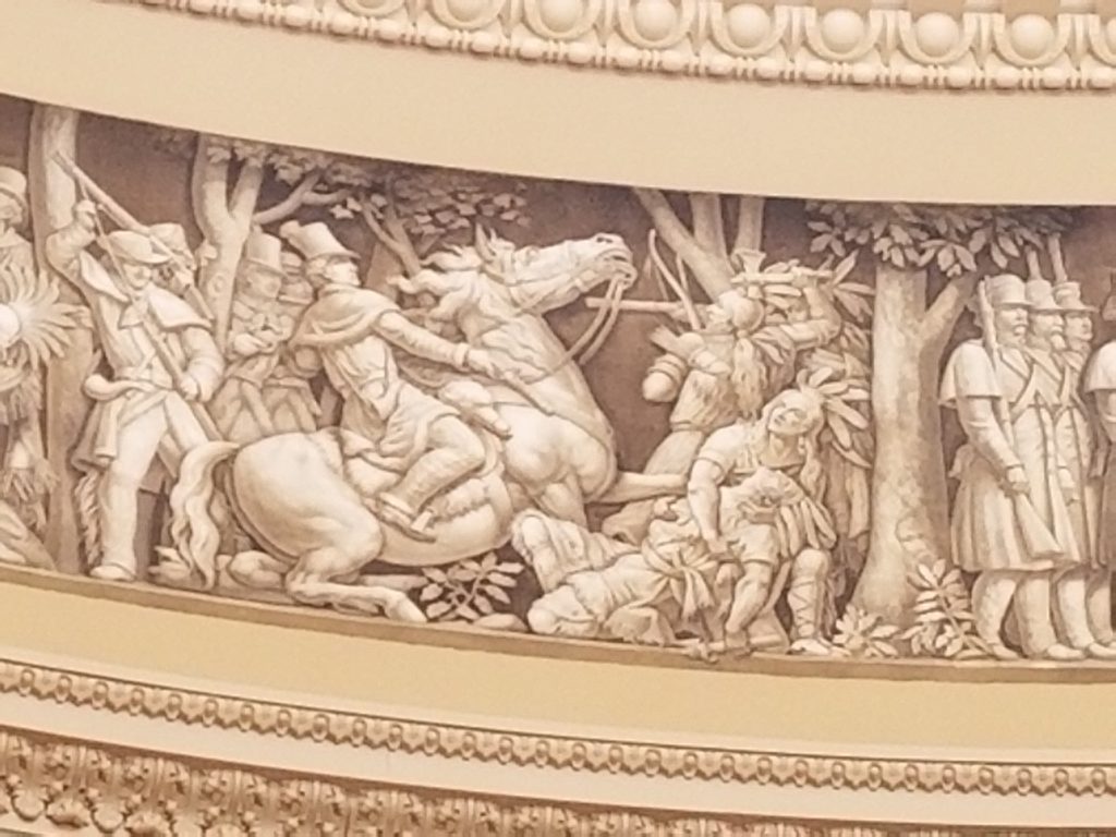
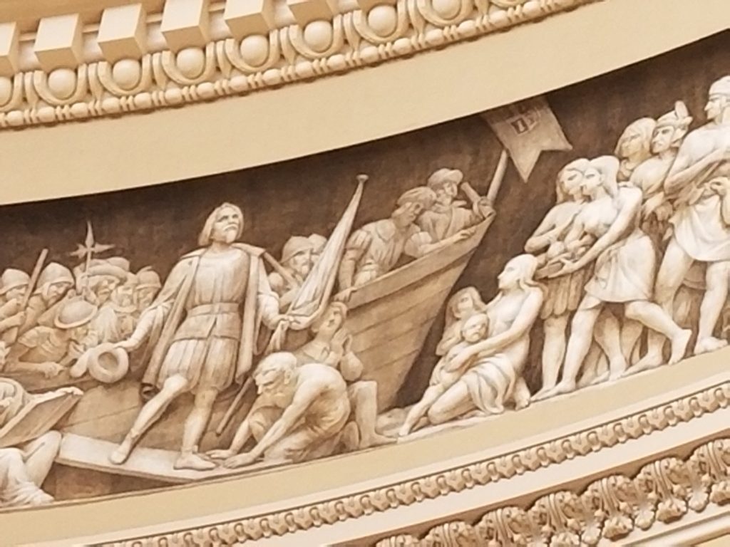
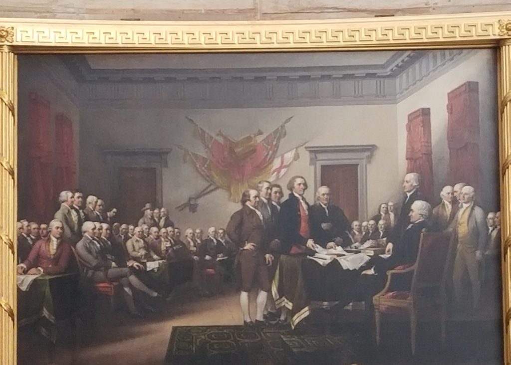
After viewing the Old Supreme Court Chamber, we at last were conducted into the Capitol Rotunda itself where we had spectacular views of the dome from the inside.  This includes an amazing panoramic mural inside the dome that convincingly looks like a series of marble sculptures documenting the history of the U.S. from the time Christopher Columbus encountered the New World in 1492 to the first Airplane flight by the Wright Brothers in 1903.  The mural was created by several artists starting in 1878 and was not completed until 1951.  There were also historic paintings that adorned the rotunda and my attention was caught by the one depicting the signing of the U.S. Declaration of Independence in 1776, Declaration of Independence by John Trumbull (1756-1843).  This is probably one of the most famous paintings in the U.S. and was painted by Trumbull to celebrate the 50th anniversary of independence in 1826, depicting 42 of the 56 signers of the key document that established the United States as an independent country.  Our guide demonstrated the amazing acoustics of the rotunda by having us stand close together near the center, remove our headsets that allowed us to more easily hear our guide, and listen as he spoke in a low voice about 30 ft away.  To our astonishment, could hear him perfectly until he walked closer to use and his voice disappeared.  In acoustics this is caused by the reflection of sound within a resonance cavity and is the same acoustics that enables the strings of an acoustic guitar to be heard.

20181107_101050

20181107_101604

See the face in the tree on the right?  It’s a self portrait of one of the artists!

20181107_101618

See the “bearded baby” just right of Coronado and his merry men?  It’s another artist “selfie!”

20181107_101812

Declaration of Independence by John Trumbull (1826) 

20181107_102227

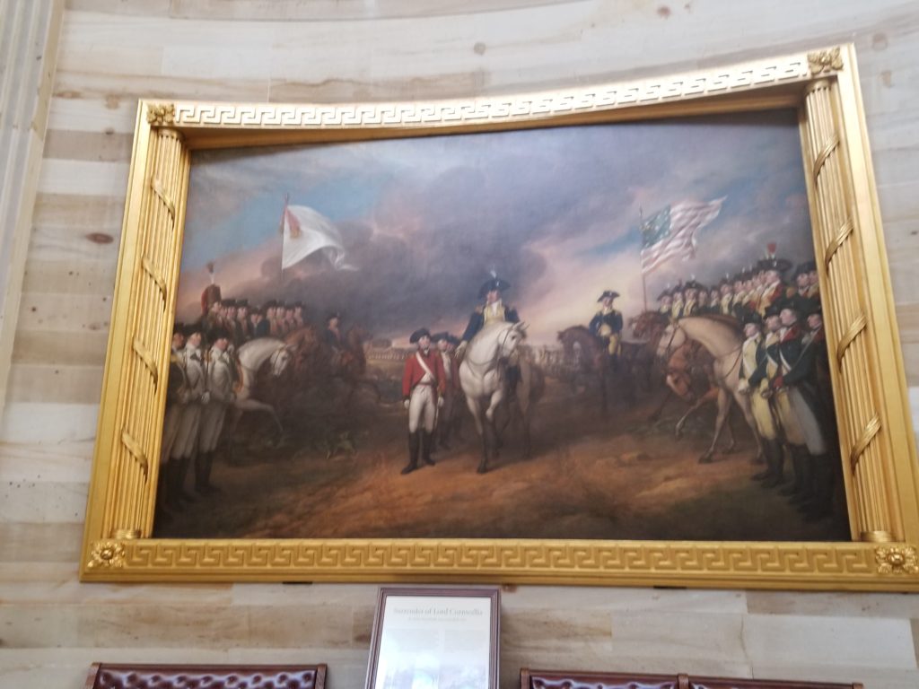
Surrender of Lord Cornwallis by John Trumbull (1826)

20181107_102214

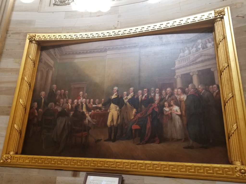
General George Washington Resigning His Commission by John
Trumbull (1826)

20181107_103529

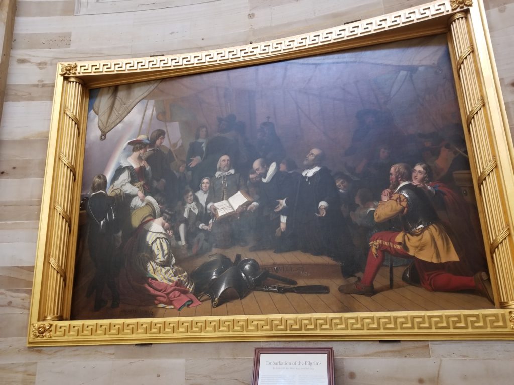
Embarkation of the Pilgrims by Robert Walter Weir (1844)

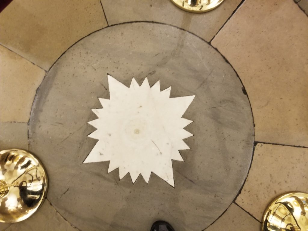
At the center of the rotunda our view was directed downward (a challenge given the incredible views of the dome interior above our heads) to a star resembling a compass.  Underneath this compass is an empty tomb that was built for George Washington (1732-1799), the first U.S. President.  However, George Washington is not buried in the city named after him.  George Washington is buried at his Virginia estate of Mt. Vernon.  Mt. Vernon is a worthwhile site to visit where you can see the actual tomb of both George Washington and his wife, Martha, and see where he lived when he was not busy commanding the Continental Army or executing his duties as president.  The compass on the floor at the center of the Capitol rotunda points along NE, NW, SE, SW, representing the four quadrants of the District of Columbia and our guide informed us that by walking a circle around the compass we pass through no fewer than six U.S. postal “zip codes.”  The District of Columbia, is a 177 square km region that is shaped like a part of a square rotated 90 degrees (hence the NE,NW,SE,SE coordinate system for its streets and addresses) that lies between the states of Maryland and Virginia.  This district represents a quintessential example of American compromise.  The district was originally created out of land carved out from Maryland and Virginia to be independent of any one state so that state could not claim greater power by being the seat of the U.S. Government.  However, it creates an interesting situation for its 693,972 residents (per the 2010 census) who are U.S. citizens, but have no direct representation in U.S. Congress.  Because the District of Columbia is not a “state,” it sends no representatives or senators to Congress.  This makes D.C. more similar to U.S. territories (e.g., Puerto Rico) in this respect.  This irony is not lost on Washingtonians, whose license plates are often emblazoned with “Taxation Without Representation,” which happened to be key cause given for the U.S. declaring independence from Great Britain in the first place.

20181107_100850

Statues Everywhere

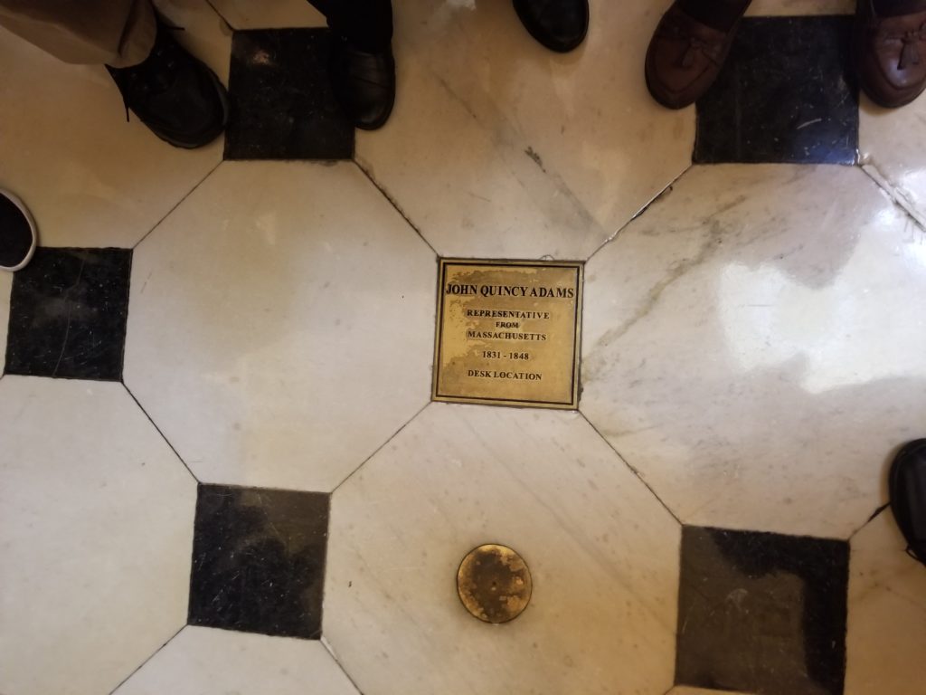
The last part of our tour was to enjoy the numerous statues (as I mentioned there are 2 for each of the 50 states at any given time) that adorn the Rotunda Room and the National Statuary Hall which was where the U.S. House of Representatives met between 1807 and 1857.  Before enjoying the statues, our gaze was first diverted downward once more to a plaque to commemorate sixth president John Quincy Adams (1767-1848) (son of second president John Adams [1735-1826]) who later served as a U.S. Representative from Massachusetts from 1831 until his death in 1848.  The plaque on the floor of this room shows the location where John Quincy Adams’ desk as a U.S. Representative and where he collapsed on 21 Feb 1848 during a contentious debate on U.S. involvement in the Mexican-American War (1846-1848), which he opposed. John Quincy Adams died two days later on 23 Feb 1848.

20181107_102907

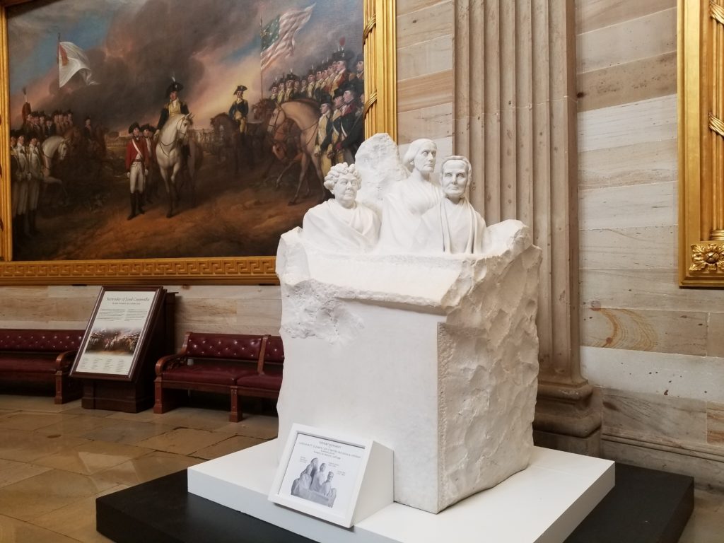
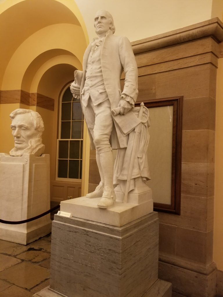
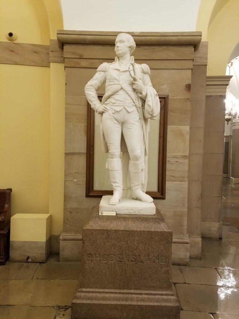
The statues in the rotunda and National Statuary Hall were impressive indeed.  There were numerous luminaries from U.S. history that included not only presidents, but also inventors, explorers, social activists, and scientists.  The U.S. capitol hosts 2 statues per state on a rotating basis (after which, the statues are returned to their representative states and usually end up in state houses or museums).

20181107_101059

Portrait Monument to Lucretia Mott, Elizabeth Cady Stanton, and Susan B. Anthony by Adelaide Johnson (1893)

20181107_100425

Caesar Rodney (Delaware) by Bryant Baker (1934)

20181107_100537

Nathanael Greene (Rhode Island) by Henry Kirke Brown (1870)

20181107_101110

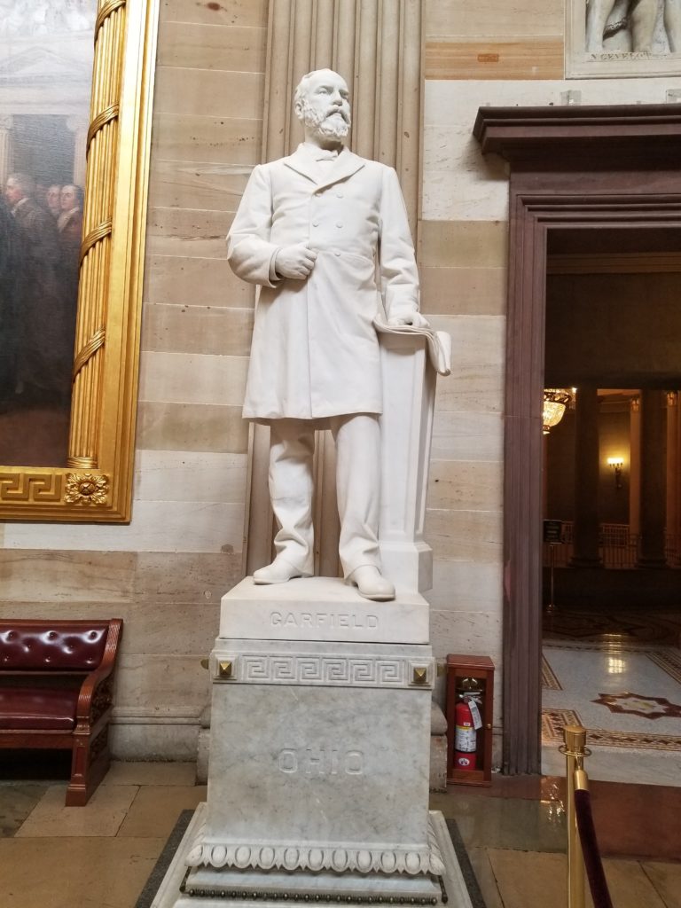
James Garfield (Ohio) by Charles Niehaus (1886)

20181107_102825

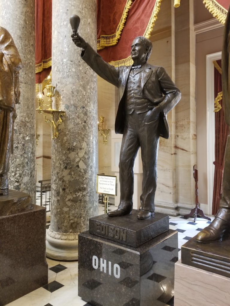
Thomas Edison (Ohio) by Alan Cottrill (2016)

20181107_102318

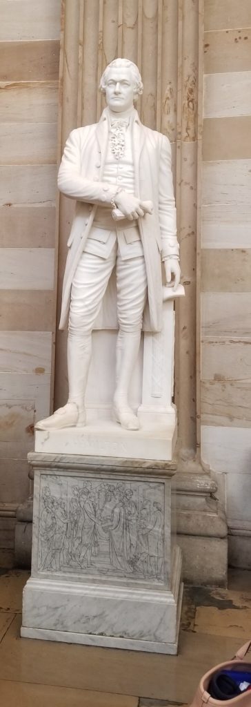
Alexander Hamilton (Artist Unknown)


20181107_101938

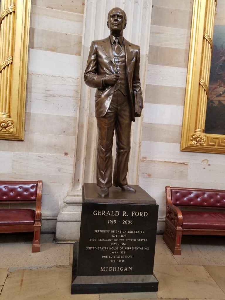
Gerald Ford (Michigan) by J. Brett Grill (2011)

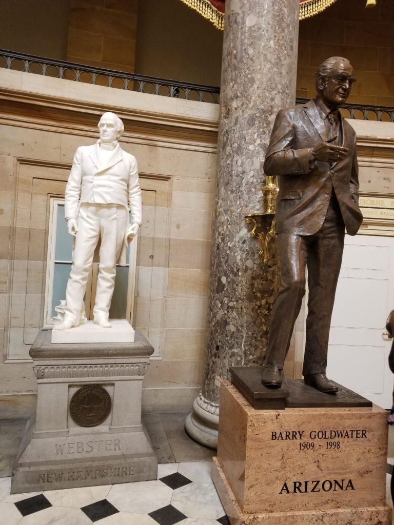
20181107_103446

Daniel Webster (New Hampshire) by Carl Conrads (1894) and

Barry Goldwater (Arizona) by Deborah Copenhaver Fellows (2015)

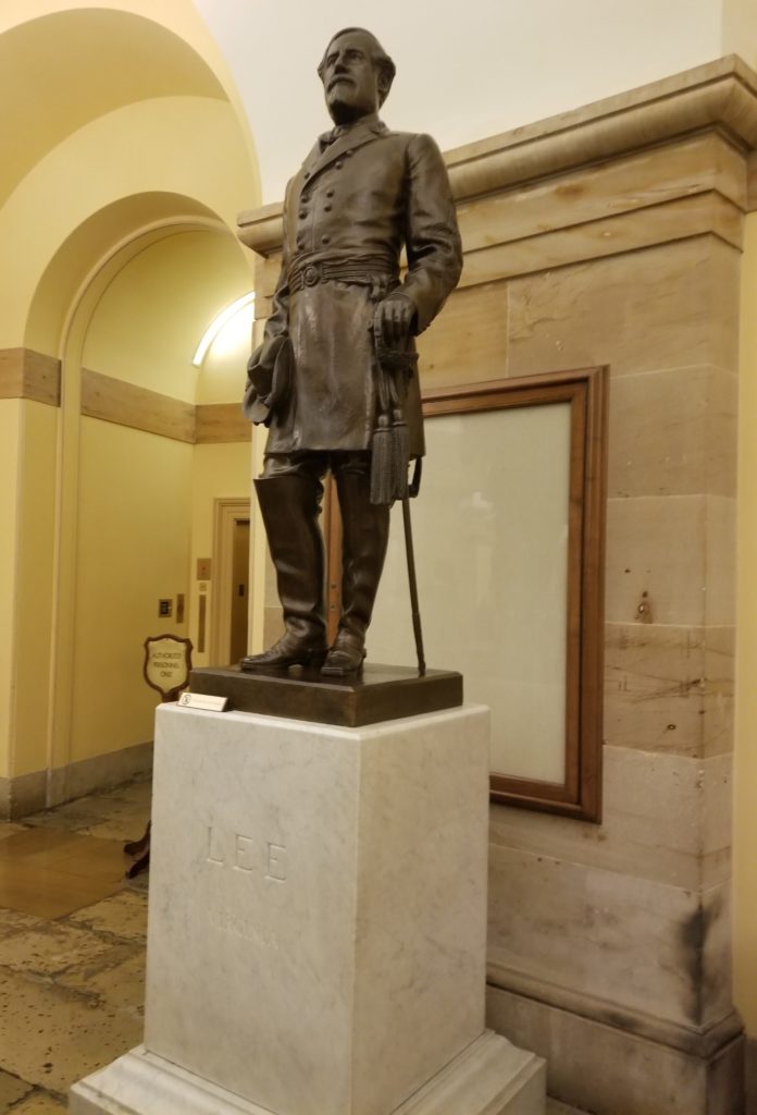
20181107_100546

Robert E. Lee by Edward V. Valentine (1909)

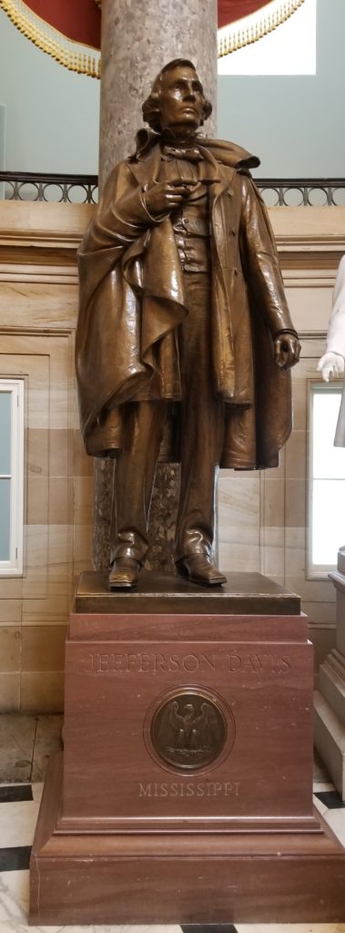
20181107_102744

Jefferson Davis (Mississippi) by Augustus Lukeman (1931)

Quick Stroll around the National Statuary Gallery

Restored Patriotism

After enjoying my Capitol tour, I felt a great sense of pride of belonging to my country that had lately been significantly absent, partly due to the seeming constant stream of bad news that bombards us from the cable news networks.  It occurred to me that despite our differences in cultural background and political views, we still need to remember that we are still one nation.  It also occurred to be that given our current seemingly-divisive politics, those in charge of our government, including the ones that work in this building (and, for that matter, the current occupant at 1600 Pennsylvania Avenue) could greatly benefit from taking a Capitol Tour from time to time to remind them of the loftier ideals of those who founded the United States and to remind them of the awesome responsibility not to themselves, but in service to our great nation as a whole.

Final Impressions

How to Visit

As with other sites in Washington D.C., I strongly recommend visiting anytime except Summer when the weather is hot and humid, and there are swarms of tourists.  October-November is a fairly good time of year to visit because the Fall colors are still visible, and the number of tourists seems significantly less.  The Capitol lies at the east end of the National Mall and is closest to the Capitol South metro station.

To find out when U.S. Capitol tours are offered and learn more about the U.S. Capitol, visit https://www.visitthecapitol.gov/

Nearby

There are lots of museums and monuments that can be visited within walking distance or a metro ride from the U.S. Capitol.  For more details, check out https://www.nps.gov/nama/index.htm and https://washington.org/.  To visit the final resting place of George Washington, you can visit Mt. Vernon (https://www.mountvernon.org/), which is just a half-hour drive from the National Mall.

Travel Your Way Dispatch – The Nevada National Security Site (NNSS) – 23 Oct 2018

Nuclear Tourist

I like to visit some unusual places.  One term for it is “dark tourism” and I would agree that visiting one of the most bombed pieces of real estate on Earth is definitely “dark.” Some years ago, I learned that it was possible to visit the Nevada National Security Site (NNSS) (formerly known as the Nevada Test Site) where the U.S. government performed full-scale nuclear testing between 1951 and 1992, and where there is still plenty of interesting nuclear research that the Department of Energy still conducts.

After signing up a year in advance (the weekly tours fill up quickly and are very popular), my wife Terrie and I were ready to get a tour of a nuclear test site in the middle of the Nevada desert.  We made a special trip to Las Vegas for our tour and stayed at the Embassy Suites by Hilton, which is just a short walk away from the National Atomic Testing Museum where our tour began.  I had visited the museum before, and it features lots of fascinating exhibits about various nuclear tests performed by the U.S. both as weapons of war and potential tools of peace.  As we were waiting for our tour bus, Terrie and I noticed mostly middle-aged couples like ourselves.  As we picked up our government-issued visitor badges Terrie wondered aloud how many of the husbands had to convince their wives to come along on a tour of a nuclear test site.  We boarded a tour bus and drove northwest out of Las Vegas on U.S. Highway 95 on our 65-mile journey to the entrance of the (NNSS) in Mercury, Nevada.

A Little Bit of History

The NNSS was created as the Nevada Proving Grounds by President Harry Truman at the end of 1950 to provide a more economical alternative to previous U.S. nuclear testing that had mostly been performed in the Pacific Ocean (e.g., the Bikini Atoll test of 1946).  Starting in 1951, nuclear tests involving air-dropped devices from B-50 bomber aircraft were conducted at the site, which is larger than the state of Rhode Island.  These tests were followed by above-ground testing that involved devices detonated from towers, suspended from balloons, and even one that was fired as an artillery projectile from a cannon.  Quite a few of these tests involved evaluations of how various structures (bridges, forests, houses, and even bank vaults) would withstand nuclear detonations.  Other evaluations involved live exercises involving soldiers to determine how they would psychologically react to a nuclear detonation and some tests involved animals (pigs were favored because their skin and organs are similar to those of humans) to determine direct radiation, heat and blast effects on people.

Much of the nuclear testing was performed as a part of the Cold War with the Soviet Union where both the U.S. and Russia tested larger and larger nuclear devices to achieve increased yield.  Eventually political and environmental concerns prompted both the U.S. and Russia to voluntarily stop testing in 1958 as the Cold War had a brief thaw.  However, a few years later tensions had increased due to events such as the building of the Berlin Wall and the downing of a U.S. U2 pilot Gary Powers.  These increased tensions prompted the Soviet Union to unilaterally break the testing moratorium in October 1961 with the largest nuclear test yet performed (50 megatons).  After the break in the moratorium, testing at the Nevada Test Site (later renamed the NNSS) significantly increased until in 1963 when the U.S. and the Soviet Union entered the Limited Test Ban Treaty, which banned all testing of nuclear weapons above ground.

Also, during the 1950s and 1960s there was a great interest in determining if nuclear devices could be used for peaceful purposes such as excavation, construction, and even natural gas exploration.  These tests did prove that nuclear devices can be used for peaceful purposes, but by the 1970s environmental concerns prompted the end to such testing.  After 1963, all tests of nuclear devices were performed underground, and these tests continued through the remainder of the 1960s until 1992 when another voluntary agreement was entered with Russia to stop all full-scale nuclear testing.  That voluntary agreement has been in place to the present day (26 years at this writing).

Even though full-scale testing ceased in 1992, there has been plenty of nuclear research performed at the NNSS.  Explosive testing of nuclear devices is performed with sub-critical yields, meaning that the nuclear devices do not go critical resulting in an actual nuclear explosion.  The site also performs real-world training of police, firefighters, and other first responders where nuclear materials are involved (e.g., if a terrorist were to jacket a conventional bomb with nuclear material to create a “dirty bomb”).  Also, the NNSS serves as a disposal site for all nuclear material used by the U.S. government, including for classified systems.  One of the most fascinating items is the Joint Actinide Shock Physics Experimental Facility (JASPER), which is a large “gas gun” that fires a projectile in a barrel containing hydrogen gas at up to 8000 m/s (or about 17,900 mph) at various nuclear material targets under controlled conditions to simulate full scale testing.

Trip to Mercury

On the way to the NNSS entrance we passed Creech Air Force Base, which is where pilots train and fly actual operations with the Predator and Raptor combat drones.  As we were driving by, we saw an unusual flying object that looked larger than a remote-controlled model airplane, but smaller than a single engine plane, such as a Cessna.  Our guide, John, informed us that what we were seeing was indeed a Raptor and told us of the psychological challenges the pilots face of going to work, flying a bombing mission from half a world away, and then calmly going home to dinner with his family.  I wondered at this technological marvel and how innocent it looked in spite of its formidable destructive capabilities.

We also passed what looked like a small church.  According to John, this was the abode of an eccentric lady who was not exactly agreeable to the activities of the NNSS and would perform a dance ceremony for visitors to restore their fertility.

John had worked at the NNSS since the early 1980s and it was clear to us that he loved his job of conducting tours like ours.  He seemed to have endless patience and stamina with answering questions, even when I noticed towards the end that some of the questions seemed to repeat earlier questions.  One question that was commonly asked was if we would need radiation detectors as we toured the NNSS.  John explained that the tour guides did originally wear radiation badges to see if tours received any significant doses of radiation, but discovered that there was no detectible difference, so they stopped wearing them.  BTW, a radiation badge does not protect you at all, but simply tells you if you have already been exposed to too much.

At last we turned off U.S. 95 on the road that led to the main entrance.  The first thing we noticed were two large “pens” made with fencing that to me resembled large dog kennels.  John informed us that these pens were there to detain protestors who had illegally trespassed onto NNSS property.  Upon being captured by the guards the trespassers would be detained in these pens until they could be shipped by bus to the Nye County Courthouse (in Tonopah, NV some 150 miles away) to face misdemeanor charges (from there it was up to the protesters to arrange their own transportation).  John also explained why there were two pens.  Apparently, the guards used to detain males and females in the same holding pen while awaiting transportation to Tonopah, but some of the detainees started getting too familiar with each other and “frolicking” (John’s own word) requiring them to be separated (to me, a dog kennel outside of a government facility in the middle of a desert did not seem to be the best place to “frolic” but I guess I am just picky).

Having solved the mystery of the pens, we were greeted by a guard at the entrance who worked for a private contractor (a typical situation for government facilities) and he checked to ensure we did not have any cell phones.  Before going on our tour, Terrie and I had to read through all of the items that are forbidden on the tour, which included weapons, cell phones, cameras, and (interestingly) Geiger counters.  John explained that if anyone was discovered with a cell phone once we entered the NNSS, the tour would be immediately cut short and we would be driven back to Las Vegas.  We all left our cell phones behind or turned them into John when we got on the bus for safekeeping, so there were no problems.

Witnesses to Armageddon

Our first top in the NNSS was at the main cafeteria for a quick snack and bathroom break.  We then set out on our tour of the NNSS.  One could not help but notice numerous signs warning about areas where you should not gather soil or did due to possible radioactive contamination.  Also, in some cases, we needed to take detours due to road closures caused by ongoing activities.

One of the first site we saw was an unimpressive set of rotting wooden benches off the side of the road.  It turns out this was seating for VIPs who witnessed above- ground nuclear tests in the 1950s.  Everyone witnessing the tests needed to wear protective goggles made of the same material as an arc welder’s shield because the flash from nuclear tests was bright enough to cause blindness.  At another location we saw trenches dug into the desert floor where soldiers took part in an exercise that involved witnessing a nuclear test.  The purpose of the exercise was not to determine effects of radiation on humans, but to determine if a soldier could function in the vicinity of a nuclear blast.  At still another location were the remains of animal pens that were used for pigs (complete with soldiers’ uniforms) that were exposed to the nuclear explosion to determine survivability (spoiler alert: they didn’t survive).

For me it is terrifying to think that the U.S. and Soviet Union considered using battlefield nuclear weapons and we were reminded of that as we peered along a small side road that led to the site of the only test of a nuclear artillery shell fired by a cannon.

At another location we could see the artifacts that were used to determine how well they could withstand the effects of a nuclear explosion.  At one location John pointed us to an area where a set of pine trees were set in cement to evaluate the effect of nuclear weapons on forests (the trees had to be brought in, as there were none to be found in the desert).  Another site that we unfortunately did not have time to visit was the site of the “Apple 2” houses (not to be confused with the home computer).  The Apple 2 houses were constructed in the mid-1950s using standard materials of the time to determine how effective civil defense measures would be in the event of a nuclear conflict.  These houses were occupied by mannequins to simulate human inhabitants.  This little “village” was featured in the film Indiana Jones and the Crystal Skull (yes, the one where Indy gets nuked in the fridge).  John’s main complaint about the film was that there was clearly an anachronistic ’57 Chevy (complete with tail fins) shown in the village even though the test occurred in 1955 (clearly he was much kinder than most other critics).

We also drove past a bank vault and a series of bridges built to evaluate effects of nuclear blasts.  The bank vault provided protection surprisingly well, but the bridges were mostly gone except for one.  We got out of the bus and stood under the bridge.  At first, I did not comprehend what I was looking at, but then I realized that the primary structural members of the bridge comprised of 24-inch I-Beams were completely bent into a hoop!  John informed us that these beams were not melted by the heat but by the extreme blast “overpressure” caused by the explosion.  For me this really drove home how powerful uncontrolled nuclear energy is.

Here are a few video links showing some of the weapons tests performed at the Nevada Test Site:

https://www.youtube.com/watch?v=5N0Balj2tLw

https://www.youtube.com/watch?v=ztJXZjIp8OA

Atoms for Peace and a Really Big Hole

Some of the research at NNSS involved peaceful uses of nuclear explosions.  This was called Project Plowshare, named after the biblical passage about “beating their swords into plowshares.”  We stopped at one location called Sedan Crater.  This was a test performed in 1962 to determine how effective a nuclear explosion would be for large scale excavation.  It turns out, you can plow a really big hole in the ground even with a fairly modest nuclear explosion  (about 100 kilotons in this case).  Nothing quite prepares you as you peer into the Sedan Crater.  It’s absolutely huge! (320 feet deep and 1,280 feet in diameter) It’s so huge that it reminded me of the extinct volcanic crater at Mt. Capulin in New Mexico.

Here is a picture of us at the edge of Sedan Crater: Public Tour Photo 10-23-18 (see if you can spot me in my snazzy Tilley Hat on the left side of the picture)

We were also shown where the U.S. government disposes of its “low activity” nuclear waste.  “Low activity” generally means waste that is not involved with nuclear weapons or nuclear power plants (e.g., spent fuel rods).  Acres of real estate were set aside to carefully account for each item of waste, place it in containers that resemble cargo carriers, and bury them in the ground.  We could see areas where the containers were in the process of being buried.  We had this part of the tour conducted by another engineer (Bill) whose wife happened to be a member of our tour.

We asked John and Bill what it was like for people who currently work at the NNSS.  Most people (Department of Energy civil servants and more numerous support contractors) live in Las Vegas and commute to the NNSS (about 2.5 hours per day).  Many of these folks work four 10-hour days so they don’t need to commute as many days of the week and the NNSS provides bus transportation for those who wish to use it.  There are two places to eat on the NNSS (the main cafeteria mentioned earlier and another smaller bistro).  The staff at the bistro deserved high praise, because they were able to prepare food for our 50-person tour (including hamburgers to order) inside of 30 minutes.  We also later found out they had stayed open late just for us because our tour was running late.

Détente and the $44 Million Museum Artifact

One of the most distinctive landmarks at the NNSS is the Ice Cap Test Site.  This site was set up in cooperation with the British government to perform a test to determine the performance of a nuclear warhead as it re-enters the atmosphere after it is fired by a missile.  This setup includes a tall white structure (over 100 ft. tall) with an elaborate set of cables and a shaft that extends another 100 ft. underground.  We got out of the bus and were able to go inside the structure to see the equipment that had been set up for a test that never happened.

The reason this test never happened was politics.  In the late 1980s, the U.S. and Soviet Union decided to reduce the number of nuclear weapons in the world and ended up eliminating all intermediate-range missiles.  As a follow-up, the U.S. and Russia decided in 1992 to voluntarily stop all full-scale nuclear testing to also include underground tests.  This voluntary agreement (that has never been signed as a formal treaty) meant that the Ice Cap test was abandoned in place.  Apparently, the British were extremely peeved at this development, as they had spent some $44 million for this test and were apparently never reimbursed for their troubles.  According to John, one participant in a tour for the UK military allegedly make a sardonic quip that the UK should start selling tickets to Ice Cap so they might recoup some of those lost funds.

Even so, it was fascinating to see a nuclear underground test setup, including all of the infrastructure abandoned but intact.  Another story John related was that one scientist who had participated in Ice Cap had realized about a decade later that he had left his notebook in one of the equipment shelters.  He was able to recover his notebook, which was right where he had left it.  One fascinating aspect of the above-ground tower is that it was designed to be reused at multiple underground test sites, and if Ice Cap had gone as planned, the tower would probably have been moved (in sections) to another location for another test.  We asked what would happen if someone were standing at ground zero of Ice Cap during detonation.  John replied that the force upward from the ground would be around 40g, which would result in such an abrupt acceleration that the muscles and organs would tear away from your skeletal structures (and you would suffer broken bones, but that would largely be incidental to already being dead).  We noticed that the equipment shelters near the tower were set up on what appeared to be “stilts,” which turned out to be shock absorbers to handle the ground effects of the explosion.

Nuclear Research in a Post-9/11 World

Given that full-scale nuclear testing had stopped in 1992 we were understandably curious about what happens at the NNSS today.  There are still weapon-related tests performed, but these are test where the nuclear material does not go critical.  From a distance we saw the Assembly Building where nuclear devices are assembled for testing.  A significant amount of care is needed to ensure this material is secure and the Assembly Buildings is one of the most secure U.S. government facilities.  Also, there are painstaking protocols that need to be followed when transporting devices around the NNSS.  Unlike a nuclear weapon, the devices that are tested do not have all of the fail-safe equipment that is designed to keep the device from exploding (e.g., in case of a failed missile launch or a plane crash), so they require significantly more security that a facility that handles production weapons.

We also had a chance to see training areas that are used by various first-responders to deal with accidents that involve nuclear materials.  These areas included a locomotive and even a Boeing 737 airliner in pieces to simulate a plane crash.  One of the biggest concerns today is not that a state actor will attack with nuclear weapons, but that a non-state terrorist group will get a hold of some nuclear material to create a nuclear weapon or simply set off a dirty-bomb that spreads nuclear material to contaminate a large area to maximize chaos and possible radiation exposure casualties.  Various port authorities across the U.S. come to the NNSS to train with equipment that can detect illicit nuclear materials.  Sometimes radiation detecting equipment will be erroneously set off by common items, such as bananas, which contain a moderate amount of a naturally-occurring radioactive potassium isotope.

Back to Sin City

On the way back to Las Vegas, John was clearly somewhat more tired from all our questions, but still willing to answer a few more.  One question asked was about the infamous Area 51, which is part of the NNSS.  It turns out there really is an Area 51 and it requires special clearances to enter.  John related that he once was conducting evacuation exercises that included an evacuation route through Area 51.  He said that it was quite a challenge to work with the Area 51 guards and he need to stick strictly to approved routes through the Area for his evacuation exercise.

The tour of the NNSS was an amazing experience.  One thing that is remarkable is that the tour itself is free as a part of the Personal Relations function of the U.S. Department of Energy (i.e., funded by your hard-earned tax dollars).  Even though there was a lot of red tape required to get on the tour, it was well worth it!

Here is a video that shows some of the highlights of the NNSS:

https://www.youtube.com/watch?v=Z7X7QNDi1mQ

Most importantly, Terrie as the spouse who couldn’t care less about visiting a nuclear test site gave the experience an 8 out of 10 rating (1 being “find any excuse not to go” and 10 being a “must see”).

How to Visit:

To plan a visit to the NNSS, simply go to their website (https://www.nnss.gov/) and select a spot on one of the tours.  The NNSS conducts monthly tours of 50 people.  The tours usually fill up completely for the entire year as soon as the spots are announced on the website.  Once you secure your slot, you must fill out some paperwork, which involves a background check by the U.S. government.  Foreign nationals may also participate (we had two Canadians on our tour).  Because the government can move rather slowly with paperwork, it is best to fill out the paperwork as soon as you select a spot on the tour.

Once you have the date of your tour, plan to drive or fly to Las Vegas, NV where there are lots of things to do and see (https://lvchamber.com/)

The tour begins at the National Atomic Testing Museum (https://nationalatomictestingmuseum.org/), which is within walking distance of the Las Vegas Strip (1.2 miles) where there are lots of hotel casinos to choose from.  Just a 10 minute walk away from the museum is the Embassy Suites by Hilton (4315 Swenson Street, Las Vegas, Nevada 89119), which is a short Uber or Taxi ride from McCarran International Airport (https://www.mccarran.com/).  The Embassy Suites is ideal for those who really are not into the noise and smoke of the casinos (or just not really into the casino thing at all).  Also, the hotel features an artificial pond that dominates the main atrium with two beautiful swans.  The Embassy Suites also features complimentary shuttles to the airport and to the Strip.


Taking the Road Less Traveled #1: A Scenic Drive Over Loveland Pass, Colorado

One of the best ways to enjoy travel without as may crowds is to get off of the main highway and take a scenic drive.  In April 2016 my wife and I drove from our home in Colorado Springs, CO to Grand Junction, CO to support our niece, Megan, who was participating in a school choir competition.

Loveland Pass is accessible via U.S. Highway 6 (US-6), which west of Denver largely follows Interstate 70 (I-70) west through Colorado into Utah.  From Colorado Springs, we drove north on Interstate 25 (I-25), then skirted around the west side of Denver on Colorado Highway 470 (C-470), and then headed west on I-70.  Driving west of Denver, we didn’t have to go far before we found ourselves surrounded by the beautiful Rocky Mountains.  To drive over Loveland Pass, we simply took Exit 216 off of I-70 (right next to the Loveland Ski Area), which bypasses the Eisenhower/Johnson Tunnel and winds all the way up to the 11,990 ft. (3,655 m) summit of Loveland Pass and back down the other side, returning us to I-70 at Exit 205 in the town of Silverthorne, CO.

The following videos show what it was like for us to drive up the pass going from East to West.

Video: Driving Up Loveland Pass from the East (1)

Video: Driving Up Loveland Pass from the East (2)

We took the pass in the spring, but as you can see it more resembled winter with plenty of snow everywhere.  Fortunately US-6 is almost always cleared of snow whenever possible to allow trucks carrying hazardous or flammable materials to bypass the tunnel portion of I-70.  It’s only about a 4 mile (6.4 km) drive from I-70 to reach the summit from the East, and only takes about 7 minutes to make the drive with favorable weather and traffic conditions.

When you reach the summit, you are at one of the points of the Continental Divide, which is also called a “hydrological divide,” meaning that rivers and streams on the east side of the divide eventually flow into the Atlantic Ocean (except for the ones at the northernmost part of the continent, which drain into the Arctic Ocean), while rivers and streams on the west side of the divide eventually flow into the Pacific Ocean.  As you stand at the summit of Loveland Pass you are nearly at timberline, which means trees can no longer receive enough oxygen to thrive.

At the summit there are several trails to nearby mountains with summits of 13,000 feet (3,962 m) or more, making it an excellent location to practice high-altitude hiking.  From the parking area you can day-hike to the summits of several peaks at 13,000 feet or more, including “Cupid’s Peak” (officially named “UN 13117”) (13,117 ft. / 3998 m), Mt. Sniktau (13,234 ft. / 4034 m ), Grizzly’s Peak (13,427 ft. / 4093 m), and if you are in the mood to bag a “14er,”  Torrey’s Peak (14,267 ft. / 4349 m).  For more details on how to hike these mountains (please see Additional Resources below).

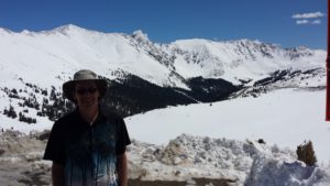
The following pictures and video show what it is like to stand on the summit of the pass.

20160421_134522 20160421_134859

Video: Up on the Summit of Loveland Pass, CO

On the way back down we passed the Arapahoe Basin (“A Basin”) Ski Area and the Keystone Ski Resort, but given it was a Thursday, they did not seem all that crowded.  It was amazing to see how high the snow banks were along the sides of US-6.  The following video shows the view as we drove past the two ski resorts down Loveland Pass towards Silverton.  The drive from the summit to Silverthorne is about 16 miles (25.7 km), requiring about 25 minutes in good weather and traffic.

These videos show what the drive back down was like:

Video: Driving Down the West Side of Loveland Pass, CO (1)

Video: Driving Down the West Side of Loveland Pass, CO (2)

Video: Driving Down the West Side of Loveland Pass, CO (3)

Upon reaching Silverthorne we decided to drive along the Dillon Dam Road, which goes along the top of an earthen dam that creates the Dillon Reservoir out of the Blue River.  Dillon Reservoir offers camping and boating, as well as featuring bicycle trails that connect to other nearby towns, including Breckenridge, Frisco, and Vail.  The following video shows the view from the top of the Dillon Reservoir Dam.

Video: Driving Over the Dillon Reservoir

This additional excursion added about 3 miles (5 km) to our journey, but was well worth it!  At the end of the Dillon Dam Road, we rejoined I-70 at exit 203 and continued on our journey to Grand Junction.

Loveland Pass allows you to get high up into the Rockies for a hike (or some skiing) and is a beautiful alternative to simply following I-70 as it tunnels through the Continental Divide.

Practical Information and Resources:

Time Required: You can easily make an excursion over Loveland Pass and be back on I-70 within an hour or less.  This mostly depends on how much time you wish to sightsee or hike at the summit of the pass.

Directions:

Loveland Pass is at the highest point of a 20 mile stretch of US-6.  On the East side, take the US-6 exit 216 off of I-70.  On the West side, take the US-6 exit 205 off of I-70.  Dillon Dam Road runs parallel to I-70 and US-6 between I-70 exists 205 and 203.

Caveats:

Driving Conditions – Especially when traveling from late Autumn through early Spring (October – April), you should check the road conditions of I-70 and US-6 before attempting to drive over Loveland Pass.  Even though both roads are generally kept clear of snow, sometimes they must be closed due to adverse weather conditions.

Hiking at Altitude – If you decide to do more than brief sightseeing, and are considering a high altitude hike, be sure to drink plenty of water, take it nice and slow, and be aware of afternoon thunderstorms which occur regularly throughout much of the late spring, summer and early autumn.  These thunderstorms can be especially dangerous at the summit of the pass because there are no trees or other protection from lightning at that altitude.  Also be aware of the symptoms of altitude sickness, which include headaches and nausea.  The surest way to cure altitude sickness is to get to lower altitudes as soon as possible.

Crowds – If you plan to head eastbound on I-70 on a Sunday (or on a Monday Holiday) towards Denver, you may want plan for an early morning drive, because the interstate becomes extremely crowded in the afternoon as many residence of the Colorado Front Range will be returning home after enjoying the mountains over the weekend.

Additional Resources (Please Click on the Links Below)

Colorado Road Conditions

Loveland Ski Area

Arapahoe Basin Ski Area

Keystone Ski Resort

Town of Silverthorne, CO

“Cupid’s Peak” / Grizzly Peak Hike

Mount Sniktau Hike

Torrey’s Peak Hike

Welcome to Travel Your Way™

This is the place to find exciting new information for your travel needs and dreams. Stay tuned…

Powered by WordPress & Theme by Anders Norén